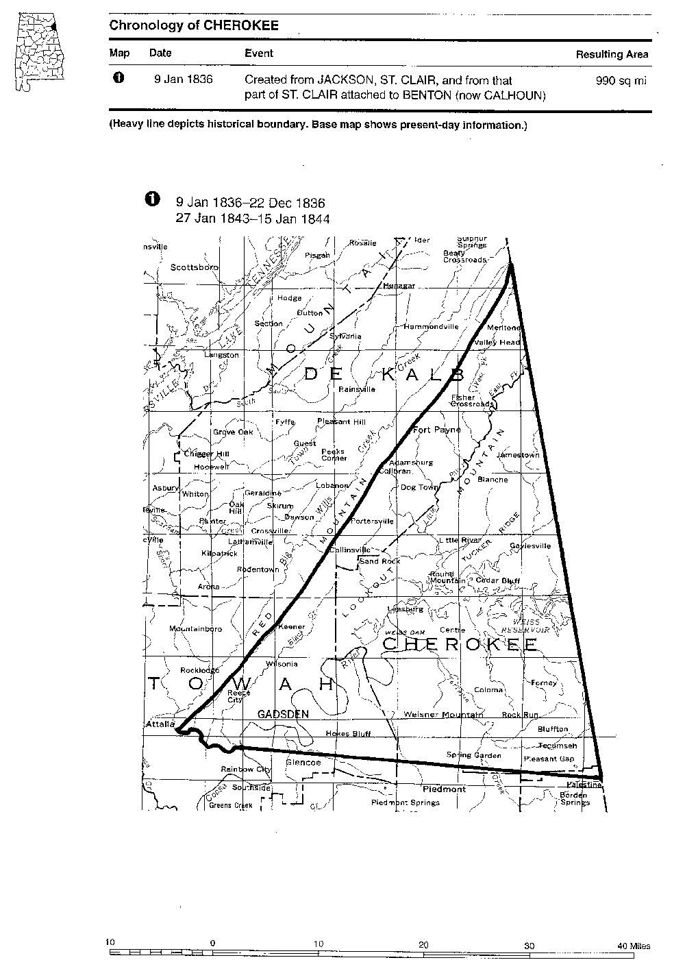
 Jan. 1836 at creation |
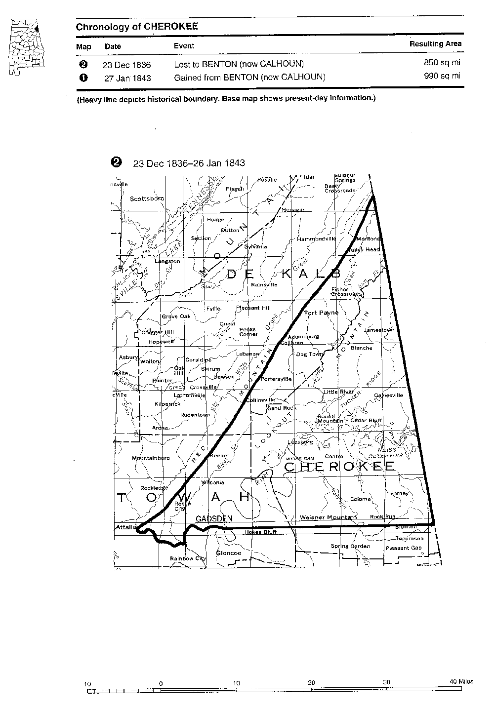 Changes 1836-43 |
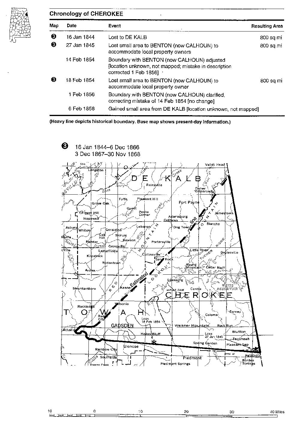 Changes 1844-58 |
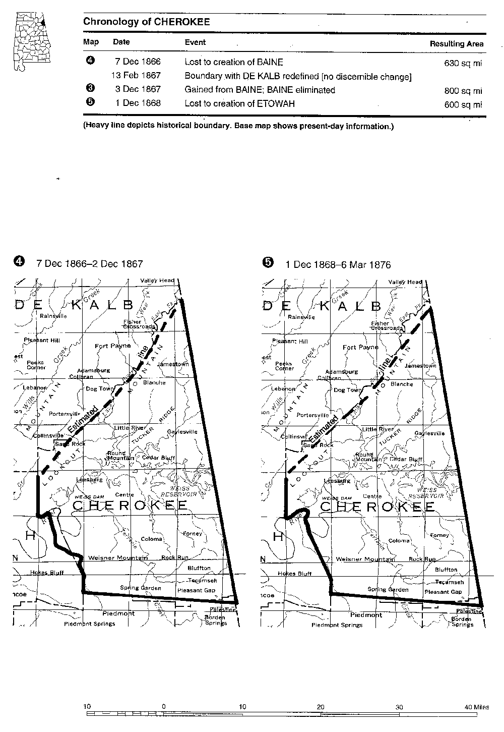 Changes 1866-68 |
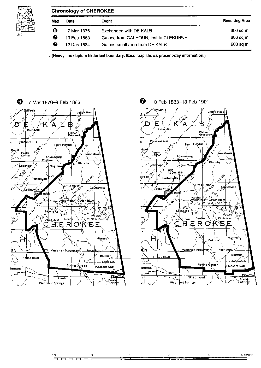 Changes 1876-84 |
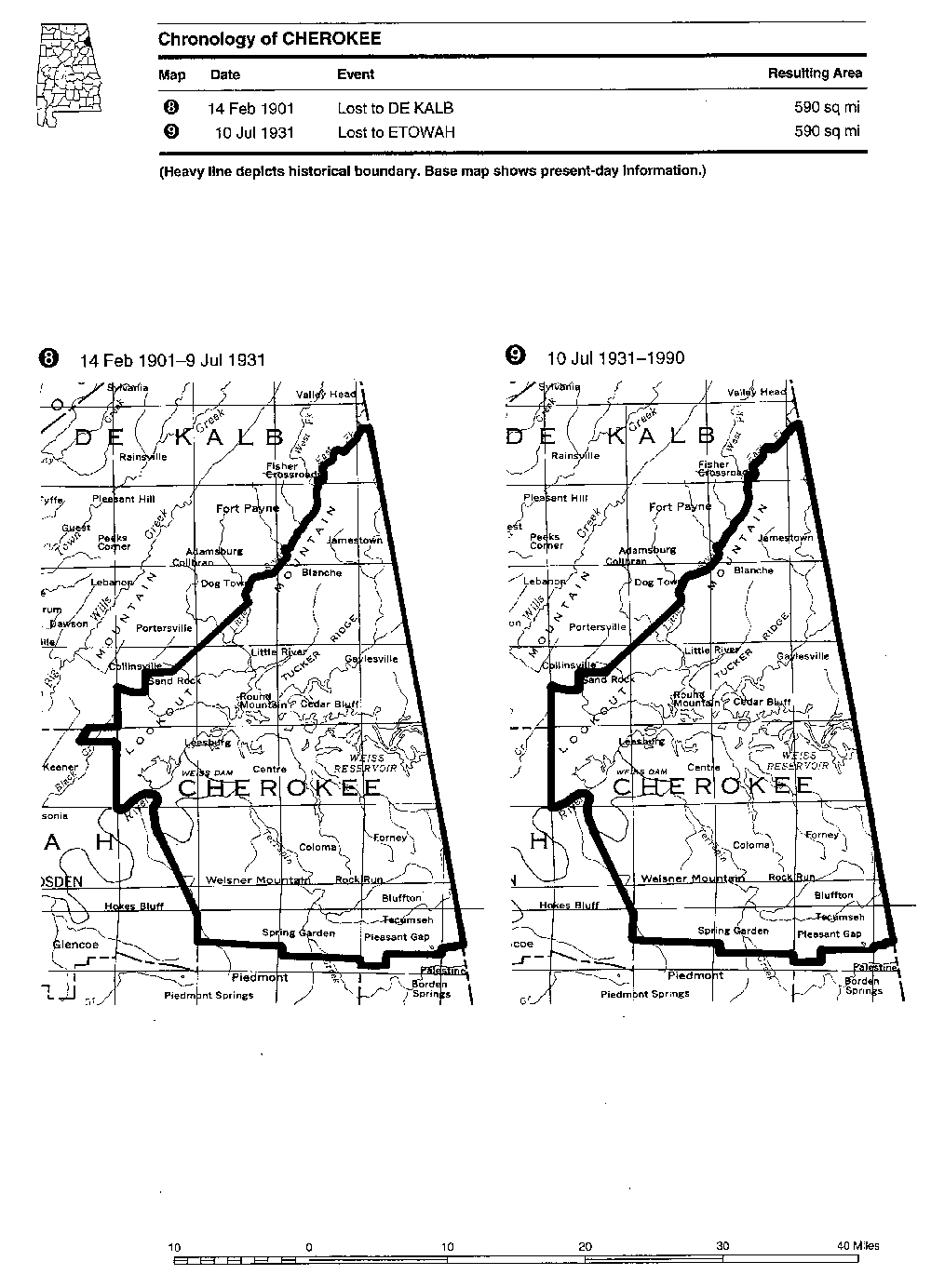 Changes 1901-31 |
Download all six maps in PDF format as boundary.zip (328Kb)
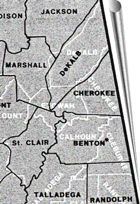
In black: Cherokee County boundary 1850 before the creation of Etowah, showing Benton.
From Thorndale and Dollarhide, "Map Guide to the United States Federal Censuses 1790-1920," p. 16. C. 1987. Geneaological Publishing Co., Baltimore