The Randolph County Land Grant Papers for Gabriel Hardin at the
State Archives of North Carolina
see The MARS Catalog, http://mars.archives.ncdcr.gov/BasicSearch.aspx
Grant, Gabriel Hardin, June 19, 1793
[Plat at top shows a rectangle with length west to east with a creek
passing through, source northwest and downstream southeast.]
Warrant No. 70.
Gabriele Hardin's, Randolph County
Surveyed for Gabriel Hardin three hundred acres of land lying on both
sides of Barnes Creek
beginning at a red oak... near the Fayette Road ... surveyed December
7th day 1796 by me William __ D__
CC:
Michael Luther, Jacob Minder
|
|
|
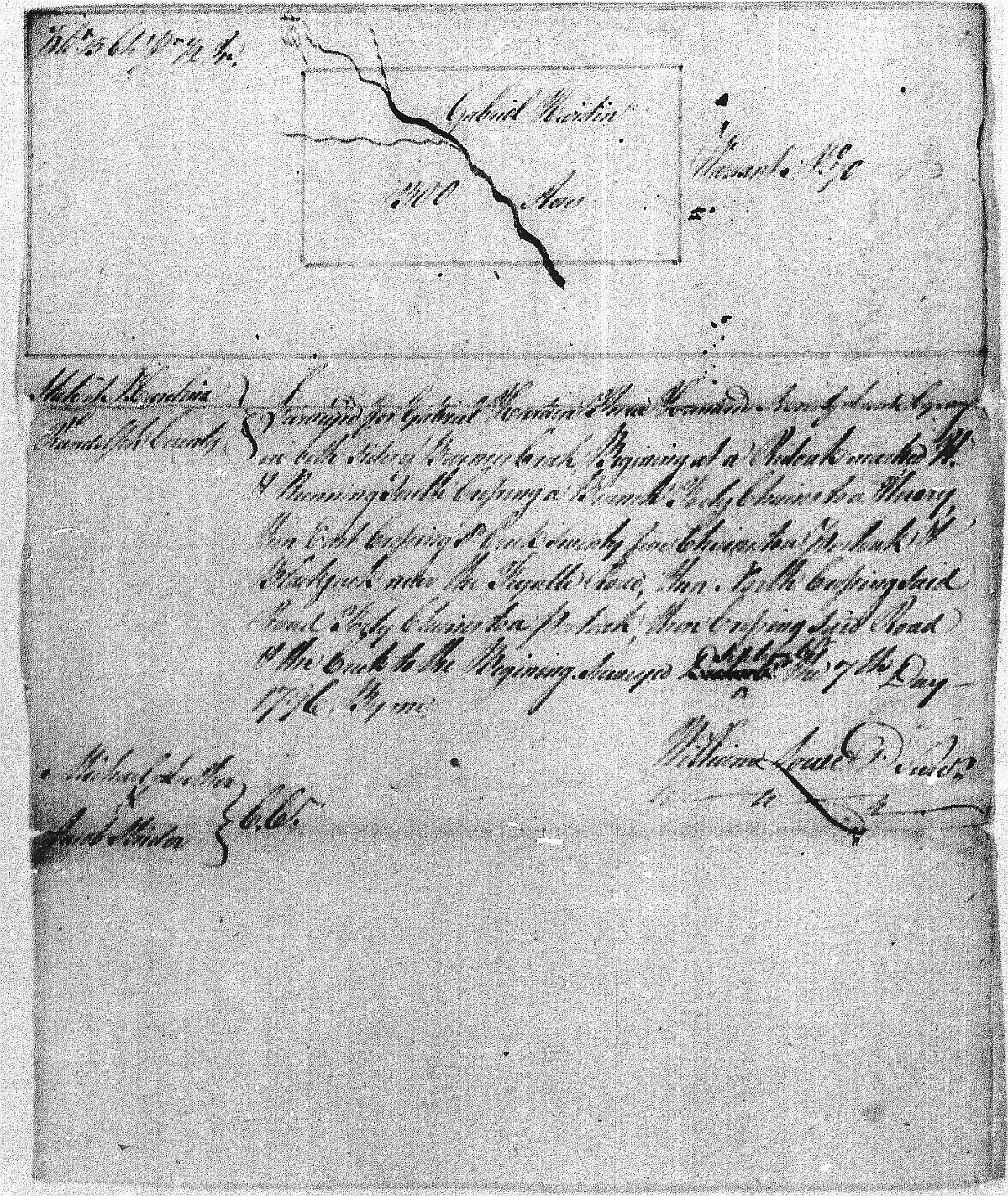
Grant, Gabriel Hardin, June 19, 1793
[Plat at top shows a rectangle with length west to east with a creek
passing through, source northwest and downstream southeast.]
"Warrant No. 70.
Gabriele Hardin's, Randolph County
Surveyed for Gabriel Hardin three hundred acres of land lying on both
sides of Barnes Creek
beginning at a red oak... running south crossing a branch ... near the Fayette Road ... surveyed December
7th day 1796 by me William Sowet Davidson
CC:
Michael Luther, Jacob Minder"
|
 7
7
The Randolph County Land Grant Papers for Gabriel Hardin at the State Archives of North Carolina
see The MARS Catalog, http://mars.archives.ncdcr.gov/BasicSearch.aspx
Grant, Gabriel Hardin, June 19, 1793
[Plat at top shows a rectangle with length west to east with a creek passing through, source northwest and downstream southeast.]
Warrant No. 70.
Gabriele Hardin's, Randolph County
Surveyed for Gabriel Hardin three hundred acres of land lying on both sides of Barnes Creek
beginning at a red oak... near the Fayette Road ... surveyed December 7th day 1796 by me William __ D__
CC:
Michael Luther, Jacob Minder
Grant, Gabriel Hardin, June 19, 1793
[Plat at top shows a rectangle with length west to east with a creek passing through, source northwest and downstream southeast.]
"Warrant No. 70.
Gabriele Hardin's, Randolph County
Surveyed for Gabriel Hardin three hundred acres of land lying on both sides of Barnes Creek
beginning at a red oak... running south crossing a branch ... near the Fayette Road ... surveyed December 7th day 1796 by me William Sowet Davidson
CC:
Michael Luther, Jacob Minder"
Our Other Web Sits
Your Web master is
Travis Hardin
Last updated 12 Dec 2017